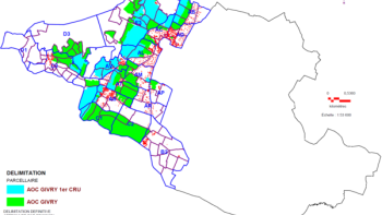
Geographical data
INAO produces maps of SIQO products. In a move to open up its data, the institute also publishes data relating to the delimitation of geographical and parcel areas. It has also opened a portal to official delimitation plans.

En 2024, à l'occasion du congrès du centenaire de l'Organisation internationale de la Vigne et du Vin (OIV) et du World Dairy Summit, l'INAO a réalisé des posters pédagogiques présentant les filières laitières et viticoles sous AOP et sous IGP.
- Les appellations d'origine protégées laitières en France - édition de novembre 2024 (format PDF / 1,6mo)
- Les vignobles sous appellations d'origine protégée en France - édition d'octobre 2024 (format PDF / 1,1mo)
- Les indications géographiques protégées laitières en France - édition d'octobre 2024 (format PDF / 915ko)
- Les vignobles sous indications géographiques protégées en France - édition de décembre 2024 (format PDF / 1,7mo)
Geographical indications maps
INAO has produced maps of products under official signs of origin and quality (SIQO). They present the delimited production areas of geographical indications by product family.
If you would like a map corresponding to the geographical area of a specific appellation or geographical indication, you can use the product search engine.

Open data
As part of an initiative to open up data, INAO has uploaded its data relating to the delimitation of geographical and parcel areas for SIQO products to the open French public data platform data.gouv.fr. They are available in .xls or .csv (for geographical areas) or .shp.
Official delimitation plans portal
INAO has set up a portal to official delimitation plans. This online service enables Internet users to consult the graphic documents materializing the delineation of the geographical area or parcel area of PDOs and PGIs.

