90 years exhibition: Archive - the parcel delimitation of the "Châteauneuf-du-Pape" AOC in 1936
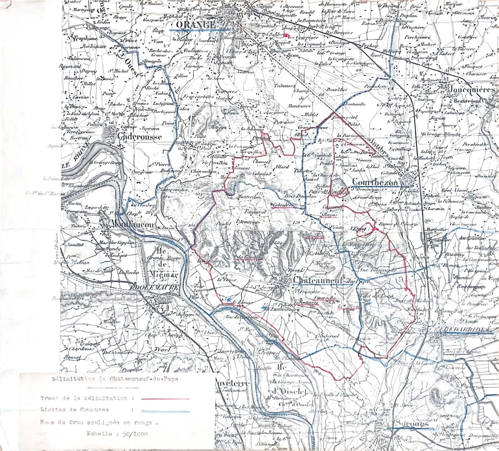
Parcel delimitation plan of the AOC "Châteauneuf-du-Pape", 1936
Realized on a printed topographic base, the map is handwritten and in color :
- The delimited area is outlined in red
- The communal boundaries appear in blue
- The names of the crus are manually underlined, also in red
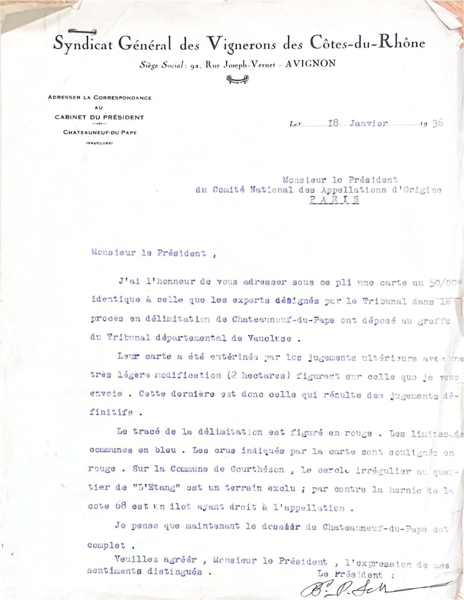
January 18, 1936 - Syndicat général des vignerons des Côtes-du-Rhône, Avignon
Typewritten letter accompanied by a hand-annotated map on topographic background, scale 1 : 50,000
In this letter addressed to Joseph Capus, then president of the Comité National des Appellations d'Origine, Baron Pierre Le Roy de Boiseaumarié transmits the definitive delimitation map of the Châteauneuf-du-Pape vineyard, validated by the Tribunal départemental du Vaucluse. This step concludes the first trial for the delimitation of a French wine-growing area, a few months after the adoption of the decree that legally founded the AOCs (July 30, 1935).
Exhibition summary: INAO, 90 years at the service of French agriculture
Documentation
Pierre Le Roy de Boiseaumarie, le premier vigneron du monde aurait cent ans
Réalisé à l'occasion de son centenaire, ce document retrace la vie et les réalisations du Baron Le Roy, figure marquante de Châteauneuf-du-Pape, cofondateur de l'INAO puis président de l'Institut de 1947 à 1967
Exposition 90 ans INAO - Panneau 14
« ARCHIVE – LA DÉLIMITATION PARCELLAIRE DE L’AOC « CHÂTEAUNEUF-DU-PAPE » EN 1936 »