90 Years Exhibition: Archive - Bordeaux wine list, 1941
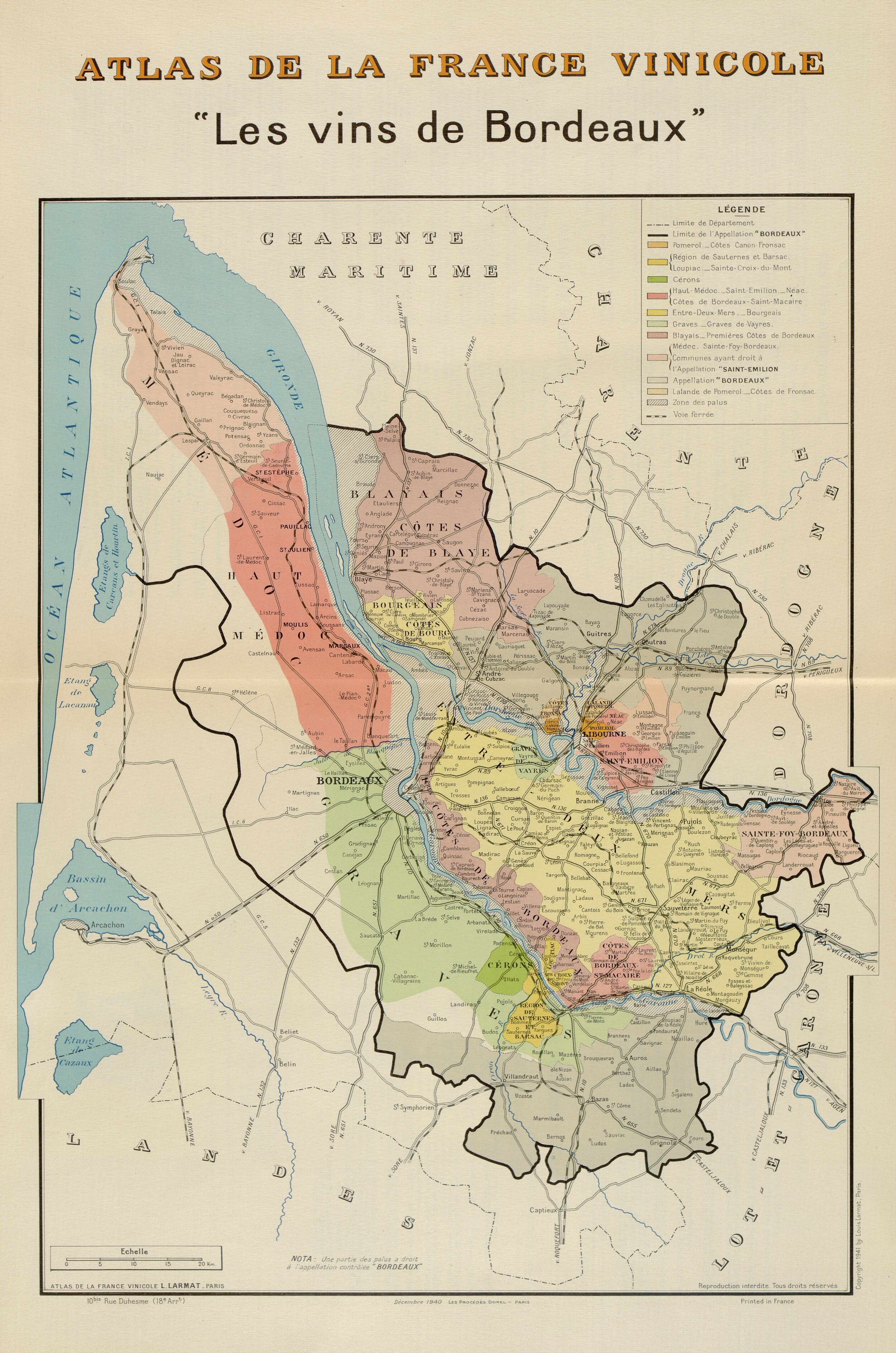
This map opens the Bordeaux volume of the Atlas de la France vinicole, published in 1941 by publisher Louis Larmat, a central figure in 20th-century French wine cartography. Produced under the high patronage of the Comité National des Appellations d'Origine (CNAO), it offers a overview of the geographical configuration of the Bordeaux vineyards, structured by the regulations of the Appellations d'Origine Contrôlée.
Each unit is located using colored surfaces, without precise cadastral or toponymic indications, with an essentially educational perspective.
The introduction emphasizes the role of the map as a mediator between production and trade. It points out that some communes have their own appellation while retaining their attachment to a general appellation. Taken as a whole, it testifies to the desire to provide amateurs and professionals alike with a coherent territorial orientation tool, in a context of recent legal structuring of wine Appellations d'Origine.

Consult l'Atlas de la France Vinicole, Carte des vins de Bordeaux, Larmat, 1941 (format PDF / 2,6mo)
To find out more...
Access all digitized sources on vine and wine, assembled over the last fifteen years by the MSH Dijon, including part of the INAO's historical archives: https://pandor.u-bourgogne.fr/fr/vigne-vin-et-gastronomie