90 years exhibition: Archive - "Côtes-du-Rhône" AOC delimitation plan, 1938
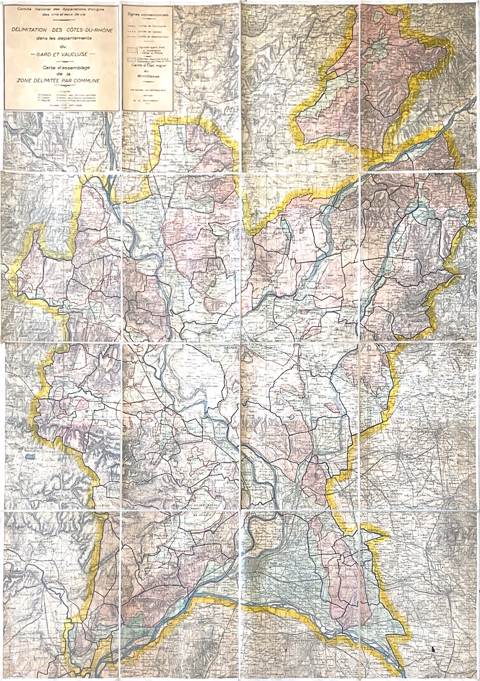
This plan de délimitation de l'Appellation d'Origine Contrôlée (AOC) Côtes-du-Rhône, produced in 1938 by the experts of the Comité National des Appellations d'Origine (CNAO), Messrs Cabane, Castel and Pasquet, takes the form of an assembly of maps on cotton canvas, at a scale of 1 : 50,000.
The base map used is an État-major map, the successor to the Cassini map, on which the experts have manually traced the flat areas of color that distinguish the appellation delimitation in vineyards located in the Gard and Vaucluse departments.
In pink, the wine-growing areas authorized to benefit from the appellation, in blue those that are excluded. On the reverse, the map is signed by the three experts, who attest to its authenticity and validity within the framework of the Appellations d'Origine regulations.

Exhibition summary: INAO, 90 years at the service of French agriculture
Download the exhibition panel
Exposition 90 ans INAO - Panneau 15
« ARCHIVE – PLAN DE DÉLIMITATION DE L’AOC « CÔTES-DU-RHÔNE », 1938 »